Marilyn Horst Collection of Aerial Photographs

Updated: Aug 9
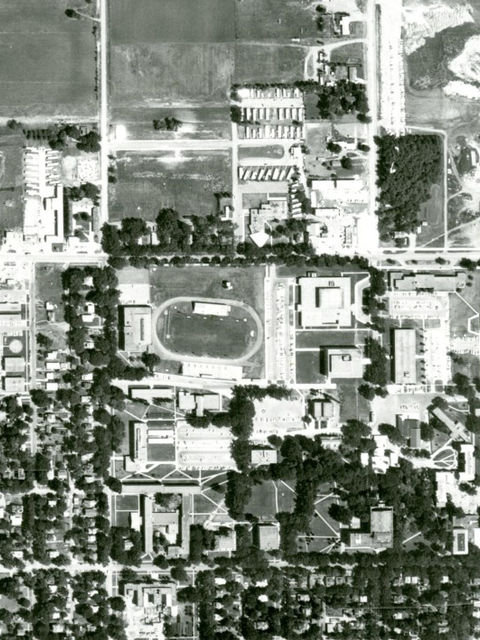
The Archives and Special Collections has recently received five 1968 aerial photographs showing parts of Vermillion or areas close to Vermillion.
These photos show that in 1968 not much of the town or the University of South Dakota was north of Cherry Street, and that the Mulberry Bend area looked very different before the construction of the bridge over the Missouri River.
Each photo shows:
VE-IJJ-24 – Southeast portion of the town of Vermillion and country to south and east.
VE-IJJ-26 – Where the Vermillion River joins the Missouri River and surrounding country.
VE-IJJ-32 – Missouri River and surrounding country in the Mulberry Bend area. Has handwritten information on photo.
VE-IJJ-34 – Southwest portion of the town of Vermillion and county to south and west.
VE-IJJ-37 – Northwest portion of the town of Vermillion and county to north and west. There is handwritten information on the photo.


Comments